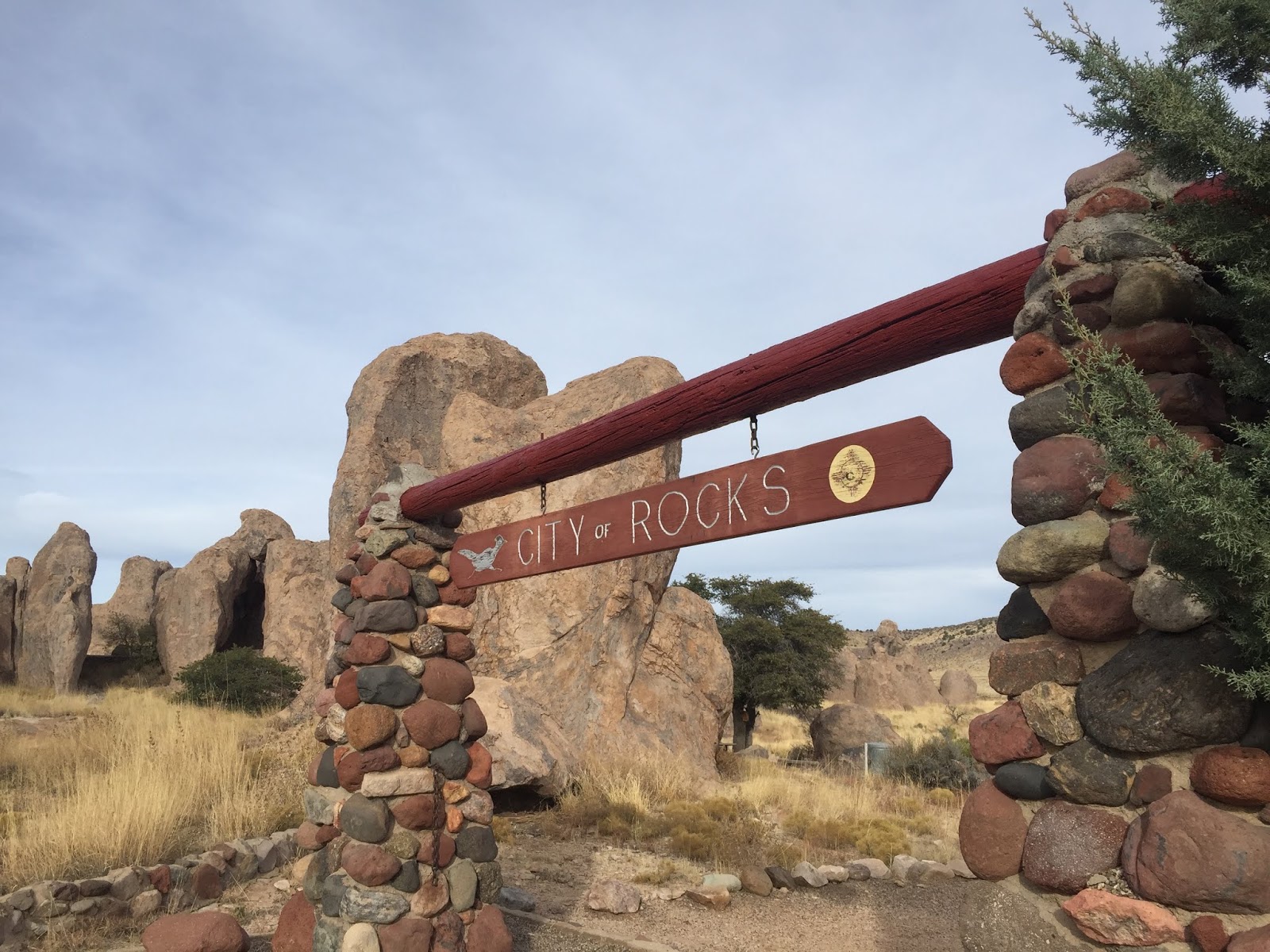
Heading East on I-10, our next campground was City of Rocks State Park near Deming, NM. What a surprising find!!! The name comes from the most beautiful volcanic rock formations, all within just one square mile in the Chihuahuan desert and at 5,200 feet elevation.
The campsites are all tucked into the large rock columns, some rising as high as 40', all separated by lanes much like a city.
The beauty of the eroded rock was something so different from other campgrounds but similar to formations we'd been seeing at other parts of the drive.
Every campsite was unique and so private, but since it was getting below freezing at night we decided to take the one available electric site, not the prettiest and not near the rocks. So glad we did, we were able to stay for three nights and explore the surrounding area and stayed comfortably warm inside.
North of the park on a long, windy and pretty remote drive was the Gila Cliff National monument. So worth the drive, 70 miles that takes over 2 hours.
There are two distinct ruin sites located within the Gila National Forest. The first we visited above Cliff Dweller Canyon are on a bluff overlooking the Gila River. It's a good hike up, about a mile, but with it being an off season time we had the ruins pretty much to ourselves and a ranger who makes that trek up and down twice each day.
Archeologists have identified 46 rooms in the five caves, though it was hard for us to identify that many. The Mogollon People are thought to have lived in the region from 1275 into the 14th century.
Reaching different levels of the rooms requires the ladder.
Returning on the loop trail back down we drove to the second site to find the caves and petroglyphs.

We returned late in the afternoon using an alternate route which took us, surprisingly, past the Chino Mine or Santa Rita outside of Silver City, NM. I had no idea it was there and to see the immense size of it was shocking. Its been in operation since 1909 mining for copper but its the immense size of it all that is the stuns at first viewing. I found this photo on the internet since its a busy highway and missed the stop at the view area. The vehicles used fit the size of the area, just gigantic!
So back to our campground and more walks around the rock formations, they were so intriguing. There were sites large enough for us to fit into, all drying camping yet so beautiful with expansive views of the desert. A return in warmer weather would be great.
And sunsets were breath taking.

Then it was time to move on just a few miles down the road to see Las Cruces and the White Sands National Monument to the east.

Phoning the campground before 4pm, we were able to have a 2 night stay in the lovely Leesburg Dam State Park. We'd looked at the Elks Lodge north of Las Cruces but too much traffic and busy-ness all around, the state park was peaceful, quiet and just what we wanted.
The drive east to White Sands was through a lovely mountain pass and then the wide stretch of desert with the dunes visible at 4200'. From early people 10,000 years ago to Spanish explorers, miners, ranchers in the surrounding grasslands, and the US Military, the dunes have been a sought after location. Though we didn't visit, there is more military history available at the White Sands Missile Range Museum and Trinity Site, the place where the first atomic bomb was tested in 1945.
A beautiful and crisp January day with walks along several of the trails.
The simplicity of the formations, so amazing! These great waves of gypsum sand create the world's largest gypsum dunefield.
There is a campground there if you are a backpacker, I think it was just a mile or two into the dunes. But we were headed back to our state park by late afternoon.
When we packed up Saturday morning with our direction southwest to El Paso, look who was in the driver's seat! By now I had a total of 100 miles driving experience, but since I was having fun with this new adventure, PK and I changed seats. Little did I know what lie ahead for me.


 Then it was time to move on just a few miles down the road to see Las Cruces and the White Sands National Monument to the east.


No comments:
Post a Comment